|
| Call Summary |
| Year | EMS | Fire | Total |
| 2012 | 562 | 338 | 900 |
| 2013 | 607 | 323 | 930 |
| 2014 | 611 | 350 | 961 |
| 2015 | 605 | 337 | 942 |
| 2016 | 729 | 308 | 1037 |
| 2017 | 718 | 364 | 1082 |
| 2018 | 804 | 403 | 1207 |
| 2019 | 816 | 411 | 1227 |
| 2020 | 934 | 492 | 1426 |
| 2021 | 1064 | 563 | 1627 |
| 2022 | 1213 | 625 | 1838 |
| 2023 | 1146 | 974 | 2120 |
| 2024 | 1378 | 853 | 2231 |
| 2025 | 1362 | 987 | 2349 |
|
|
|
|
|
|
|
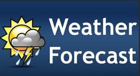
Weekend Forecast
Deputy Chief Chris Howell, July 31
On and Off Rain today through Saturday Night. Rain may be Heavy at times tonight with Chances of Thunderstorms.
There is a chance of Localized Flooding today through Saturday.... (Full Story & Photos)
|

|
|
National Night Out 2026
Deputy Chief Chris Howell, July 31
Join us for the National Night Out, Tuesday August 4, 2026. The Pingree Grove & Countryside will be participating at both the Pingree Grove and Campton Hills National Night Out. We will have handouts & Personnel and Vehicles at both the Pingree Grove & Campton Hills Events.
Pingree Grove:
Pingree Grove Police Department
One Police Plazza
Pingree Grove, IL 60140
Campton Hills:
Congregational Church ... (Full Story & Photos)
|
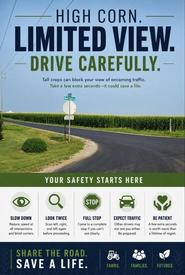
Drivers Safety
Deputy Chief Chris Howell, July 31
Tall Crops can Block your Views while driving Especially at intersections. Take extra time, make a complete stop, look twice, slow down and make sure there is no traffic headed in your direction on the cross streets.... (Full Story & Photos)
|
|
|
Weather Forecast
Deputy Chief Chris Howell, July 30
Friday the Forecast is for Rain, the Entire Fire District is in the Enhanced Risk Area (Level 3) for Excessive Rain and the Slight Risk Area (Level 2) for Lighting.... (Full Story & Photos)
|
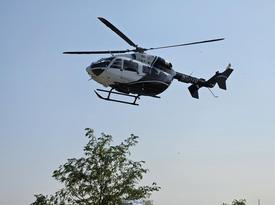
Training
Deputy Chief Chris Howell, July 30
All of our shifts and the Burlington Fire Protection District attended Landing Zone Training compliments of Air Methods this week at Pingree Grove Station 1.... (Full Story & Photos)
|
|
This website was designed for computer use. Your feedback is important to us; Feel free to sign the guestbook.
|
|
|