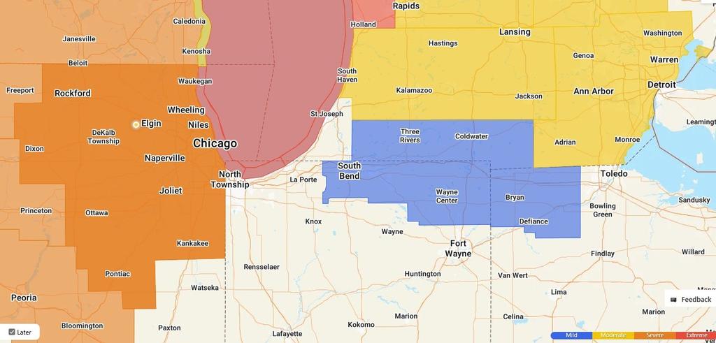
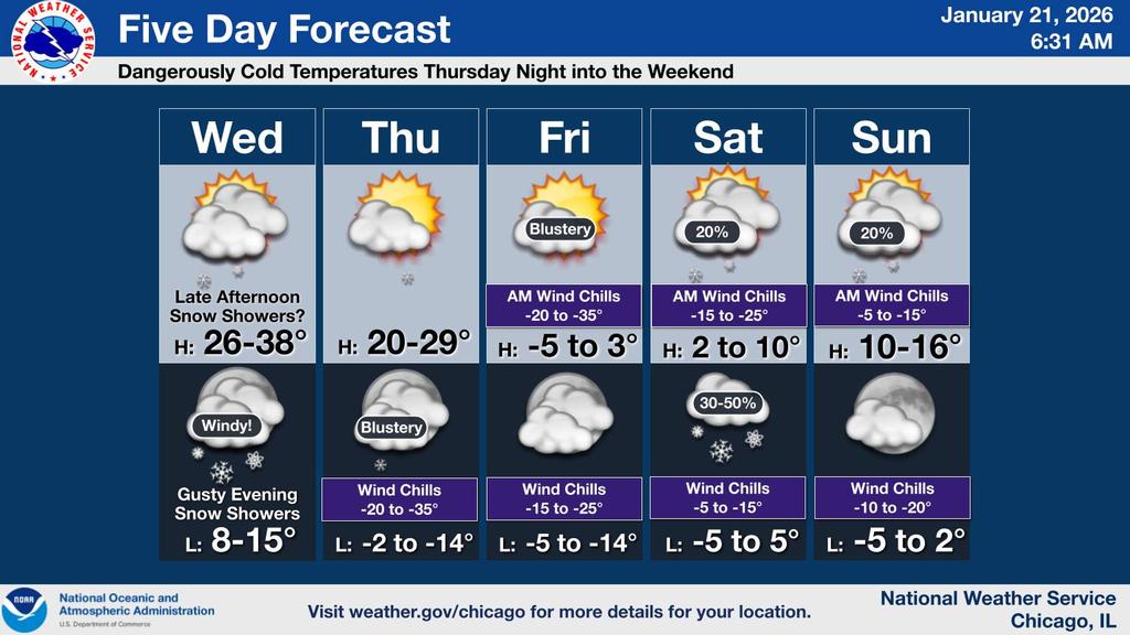
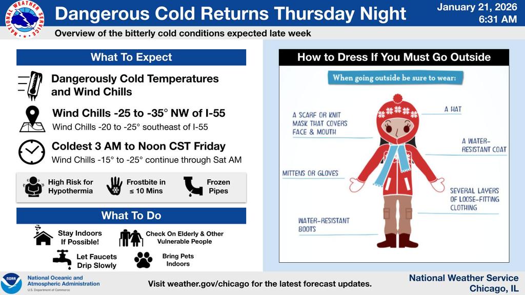
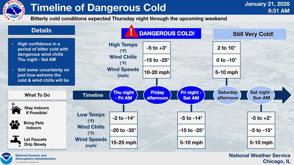
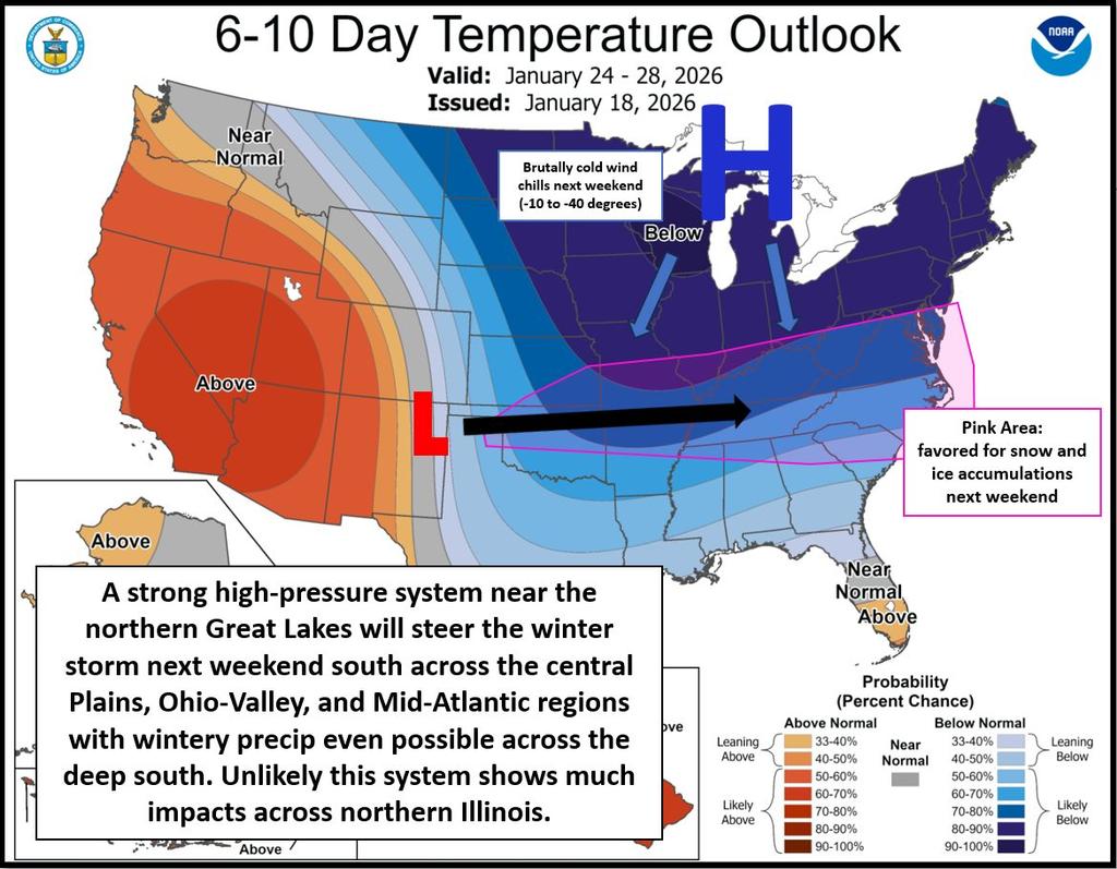
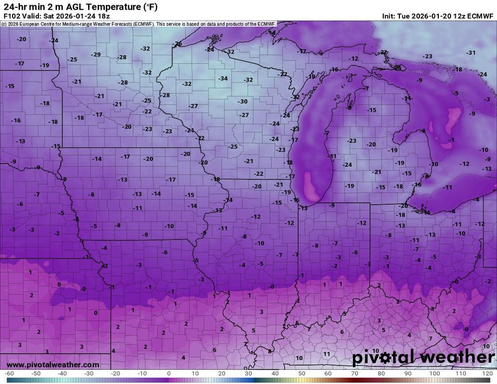
| Extreme Cold Alert for our area Starting Thursday Night/Friday Morning and continuing through Monday Morning. Temps Thursday Night/Friday Morning and Friday Night/ Saturday Morning from -10 to -20 Degrees and Wind Chills - 25 to - 40 Degrees in the Fire District.
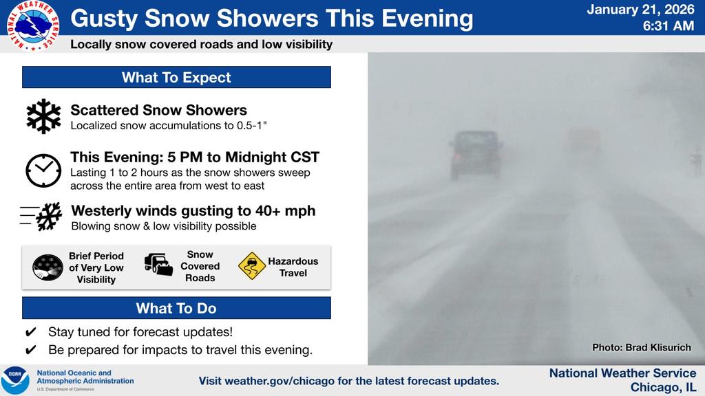
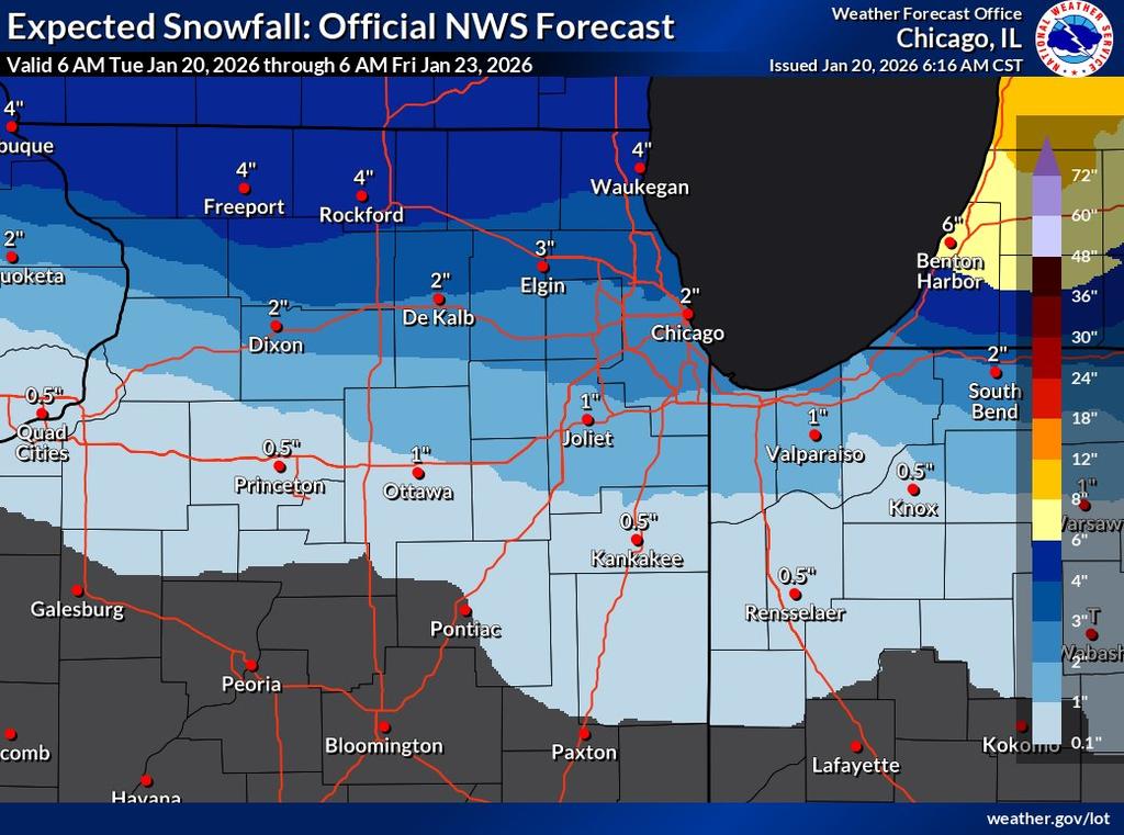
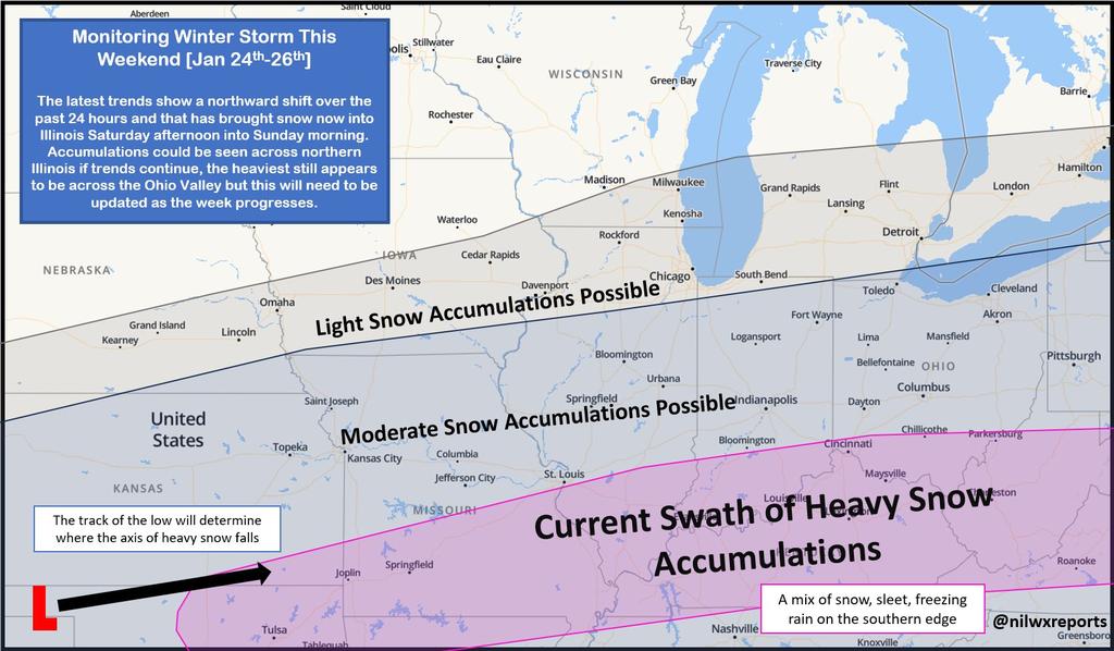
Gusty Snow Showers this Evening with 0.5 to 1 inch of Snow expected. Blowing Snow and Limited Visibility Expected. A Large Snowstorm has been tracking Thru Southern Illinois for this Weekend with light Accumulations possible for our area. This Storm has been reforecast over the last few days and each time it has been tracking more north. We may end up with a Heavy Snowstorm there will be more to follow for the weekend Snow. Stay Indoors, if Possible, Keep your Pets inside and Check on Neighbors, Elderly and other Vulnerable People. Stay Warm and Safe. |